
Posted by itamair on January 19, 2012 at 8:20pm
It was a matter of calling Drupal bootstrap from outside it, carefully setting ups db_queries and taking advantage and proper use of entities fields' properties by EntityQueryField.
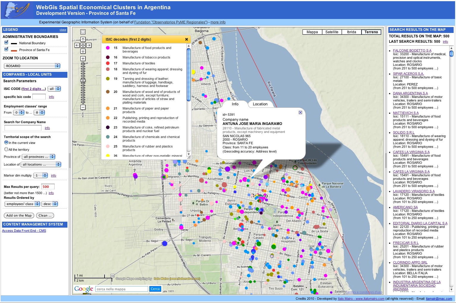
The rough backend geodata in Drupal might be managed in different ways and modules (Geofield, Geolocation, Getlocation, whatever ... ) ... but the way it's shown in the front end is just a matter of html, javascript/jquery & json creativity ...
Feeds module was the biggest help for the migration of data from the original mysql db.
And now it works, and it works great ... also with a lot of (demo) data.
Have a look, if you care ...
http://geoargentina.italomairo.com/main_map_cms.php
| Attachment | Size |
|---|---|
| drupal_webgis_20_preview.jpg | 576.3 KB |
Comments
It looks interesting. Do you
It looks interesting. Do you still have the old site using WebGis and Google Maps to see the difference, please?
the old web site link is this
the old web site link is this one: http://geoargentina.italomairo.com/main_map.php
As you can see there is no difference at all, but the last link, below in the left navigation bar, that sends to the drupal back end interface to manage data.
That is the nice thing: you can actually create you own front end (from scratch, without using Drupal themese or its maps modules) to expose google map or what ever (also openlayers, ecc.). The proper php controller links the front end (your personal one) to drupal database, bootstrap and all its core and modules functions ...
I used drupal map modules just to manage the data (also geographical info) in drupal backend.
;-)
Digital Communication, Web 2.0 & Web Gis 2.0 Opensource
www.italomairo.com
email: itamair@me.com